Remote Sensing and Site Analysis: Revolutionizing Precision in Construction Estimation
The construction industry has long been a crucible of innovation, constantly evolving to meet the demands of modern society. One such technological advancement that has revolutionized the construction sector is the integration of remote sensing and site analysis into construction processes. This dynamic duo of technology has ushered in a new era of precise estimation in construction, promising more accurate project planning, reduced risks, and greater efficiency by leveraging satellite imagery, drones, and other remote sensing technologies. In this comprehensive article, we will delve into the world of remote sensing and site analysis, exploring their pivotal roles and transformative impact on the construction landscape.
The Genesis of Remote Sensing and Site Analysis
Defining Remote Sensing
Remote sensing, in its essence, refers to the acquisition of information about an object or phenomenon without direct contact. In the context of construction, it entails gathering data about the construction site and its surroundings from a distance, typically using aerial or satellite imagery, drones, and various sensors. This technology has found profound applications across various industries, from agriculture and forestry to environmental monitoring and urban planning.
Unpacking Site Analysis
Site analysis, on the other hand, involves a comprehensive evaluation of the construction site to gather essential information for project planning and execution. It encompasses a multitude of factors such as topography, geology, climate, vegetation, infrastructure, and regulatory considerations. The primary aim of site analysis is to furnish construction professionals with a holistic understanding of the site's conditions and constraints, equipping them to make well-informed decisions.
The Synergy of Remote Sensing and Site Analysis
The integration of remote sensing and site analysis in construction represents a fusion of technology and expertise, offering a plethora of benefits and applications.
Let's dissect how these two components work in unison to revolutionize precise estimation in construction.
Site Selection and Assessment
Selecting the optimal site for a construction project is paramount, as it can significantly influence the project's success. Remote sensing technologies enable construction professionals to remotely assess potential sites, even in remote or inaccessible areas. Through satellite imagery and aerial surveys, they gain valuable insights into the terrain, land cover, and environmental conditions of the sites. Armed with this data, professionals can make informed decisions, identifying sites that offer favorable conditions and steering clear of those beset by unfavorable factors.
Terrain and Topographic Analysis
A profound understanding of the site's terrain and topography is crucial for precise estimation in construction. Remote sensing technologies facilitate the creation of highly accurate digital elevation models (DEMs) and topographic maps. These data sets play a pivotal role in grading and earthwork calculations, foundation design, and drainage planning. By remotely analyzing the topography, construction teams can proactively anticipate challenges and optimize construction methods.
Environmental Impact Assessment
Environmental considerations have taken center stage in construction projects, with regulations and sustainability becoming paramount. Remote sensing aids in assessing the environmental impact of a project by providing insights into vegetation, water bodies, and sensitive ecosystems. This data equips construction teams to develop strategies for mitigating environmental damage and ensuring compliance with regulations, thereby harmonizing construction with the environment.
Infrastructure and Utilities Mapping
Before breaking ground on a construction project, it is imperative to have a comprehensive understanding of existing infrastructure and utilities. These include roads, pipelines, electrical grids, and more. Remote sensing technologies create detailed maps of these features, mitigating the risk of accidental damage during construction and facilitating the planning of utility relocations when necessary.
Safety and Risk Assessment
Construction sites can be fraught with hazards, and ensuring the safety of workers and the project is paramount. Remote sensing aids in assessing potential risks, such as geological hazards (e.g., landslides), flooding, or proximity to industrial facilities. By identifying these risks in advance, construction teams can implement safety measures and develop robust emergency response plans, thereby mitigating risks to life and property.
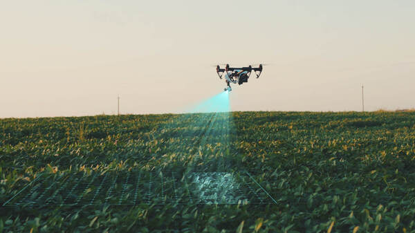
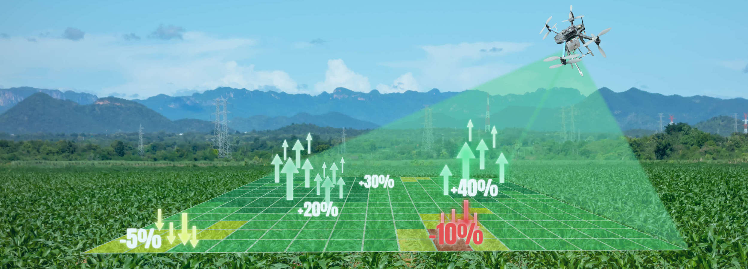
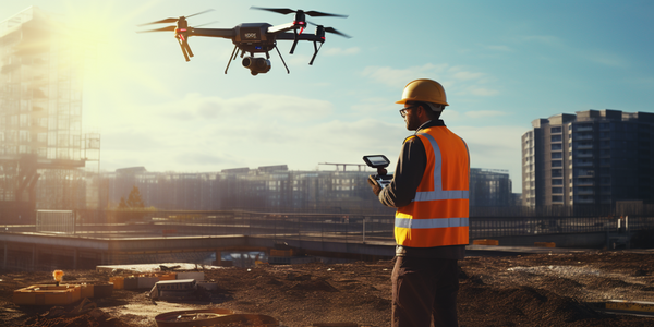
The Ascendance of Drones in Site Analysis
While remote sensing encompasses a range of technologies, one standout star in site analysis is the use of drones, also known as Unmanned Aerial Vehicles (UAVs). Drones have rapidly gained popularity in the industry due to their versatility, affordability, and ease of use.
Here's how drones are revolutionizing site analysis:
High-Resolution Imagery
Drones equipped with high-quality cameras can capture detailed aerial imagery of construction sites. These images provide construction professionals with up-to-date visuals of the site, allowing for precise measurements and assessments. The granularity of data obtained from drones is unparalleled, providing a level of detail that was once inconceivable.
3D Mapping and Modeling
Drones are capable of creating 3D models of construction sites, offering architects, engineers, and project managers a comprehensive view of the project area. These 3D models enable stakeholders to visualize the project's progress and potential challenges, making them invaluable tools for project planning and execution.
Progress Monitoring
Drones have become indispensable for conducting regular site inspections. This capability allows construction teams to monitor progress and identify discrepancies in real time. By proactively addressing issues as they arise, project timelines can be adhered to, and quality standards can be maintained.
Cost Savings
The use of drones in site analysis can lead to significant cost savings. Drones can cover large areas quickly and efficiently, reducing the need for manual surveys and data collection, which can be both time-consuming and expensive. This technology streamlines the data collection process, enabling construction teams to allocate resources more effectively.
Applications of Remote Sensing in Construction
The applications of remote sensing in construction are diverse and continually expanding. Here are some key areas where remote sensing technology plays a crucial role:
Quantity Estimation
Accurate quantity estimation is essential for budgeting and resource allocation. Remote sensing, combined with geographic information systems (GIS), facilitates precise measurements of earthwork volumes, material stockpiles, and excavation quantities. This data empowers construction professionals to make accurate cost estimates and effectively plan resource allocation.
Site Preparation and Grading
Efficient site preparation and grading are vital components of construction projects. Remote sensing data helps in optimizing these activities by providing insights into topography and terrain. By analyzing this data, construction teams can determine the most efficient and cost-effective methods for grading and excavation, ultimately leading to optimized site utilization and reduced earthmoving expenses.

Project Scheduling
Efficient project scheduling hinges on accurate information about the construction site. Remote sensing data assists project managers in creating realistic schedules by factoring in variables such as weather conditions, terrain challenges, and logistical considerations. This proactive approach minimizes delays and ensures the project stays on track for timely completion.
Risk Mitigation
Construction projects are not immune to risks, which can range from natural disasters to environmental issues. Remote sensing technology plays a critical role in risk mitigation by monitoring weather patterns, soil conditions, and potential hazards. Early warning systems informed by remote sensing data allow project teams to take preventive measures and minimize disruptions.
Environmental Compliance
Environmental regulations are stringent in many regions, requiring construction projects to minimize their impact on ecosystems. Remote sensing data aids in environmental compliance by monitoring vegetation changes, water quality, and wildlife habitats. It helps in developing strategies to protect natural resources and meet regulatory requirements.
Real-Life Examples of Remote Sensing in Construction
Let's delve into a few real-life examples of how remote sensing and site analysis have made a significant impact on construction projects:
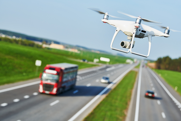
Highway Construction
In highway construction, accurate terrain and topographic data are crucial for road design and planning. Remote sensing technologies, including LiDAR (Light Detection and Ranging) and drones, are used to create detailed elevation models and terrain maps. This data helps engineers design roads that are safe and efficient, reducing construction costs and minimizing environmental impact.
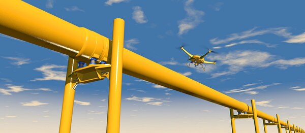
Pipeline Installation
The construction of pipelines for transporting oil, gas, or water requires precise planning to avoid accidents and environmental damage. Remote sensing is used to assess the pipeline route, identify potential hazards, and monitor construction progress. Drones are particularly valuable for inspecting hard-to-reach areas and ensuring the integrity of the pipeline infrastructure.
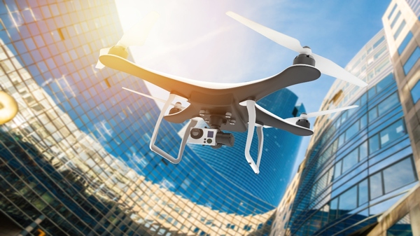
Large-Scale Building Projects
When constructing high-rise buildings or large infrastructure projects in urban areas, site analysis is complex due to limited space and numerous surrounding structures. Remote sensing technologies help architects and engineers assess the urban environment, including the proximity of existing buildings, utilities, and transportation networks. This information informs the project's design and logistics planning.
Challenges and Considerations
While remote sensing and site analysis offer numerous benefits to construction projects, several challenges and considerations must be addressed:
Data Accuracy and Quality
The accuracy and quality of remote sensing data depend on various factors, including the technology used, atmospheric conditions, and sensor calibration. It is essential to ensure that the data collected is reliable and suitable for the intended purpose.
Data Processing and Integration
Handling and processing large volumes of remote sensing data can be daunting. Construction teams must have the necessary tools and expertise to process, analyze, and integrate this data into their project workflows effectively.
Regulatory Compliance
Construction projects are subject to various regulations, and remote sensing activities may require permits or approvals. It is crucial to comply with local laws and regulations related to drone flights, data collection, and environmental impact assessments.
Data Security and Privacy
Protecting sensitive project data, especially when using drones or satellite imagery, is paramount. Construction companies must implement robust data security measures to prevent unauthorized access or data breaches.
Training and Skill Development
Professionals involved in construction projects need training to effectively use remote sensing technologies. Investing in staff training and skill development is essential for maximizing the benefits of these tools.
.jpg)
Future Trends and Conclusion
The integration of remote sensing and site analysis into construction processes is not a mere trend; it is a transformative paradigm shift that promises to reshape the industry. As technology continues to advance, construction professionals must embrace these innovations to stay competitive and deliver projects that adhere to the highest standards of accuracy and efficiency.
The future of construction lies in the hands of remote sensing and site analysis, promising a brighter, more sustainable, and more precise era for the industry. As the construction landscape continues to evolve, the synergy between technology and expertise will be the guiding light, illuminating a path to better, more efficient, and more sustainable construction projects. Precise estimation in construction, once an elusive goal, is now within reach, thanks to the remarkable fusion of remote sensing and site analysis.
Check https://app.bidlight.com for how BidLight can help you estimate your BIM model!